PyLandslide is a machine learning-assisted open-source Python tool for landslide susceptibility mapping and uncertainty analysis.
For details on how to install and use the tool, please refer to the Documentation.
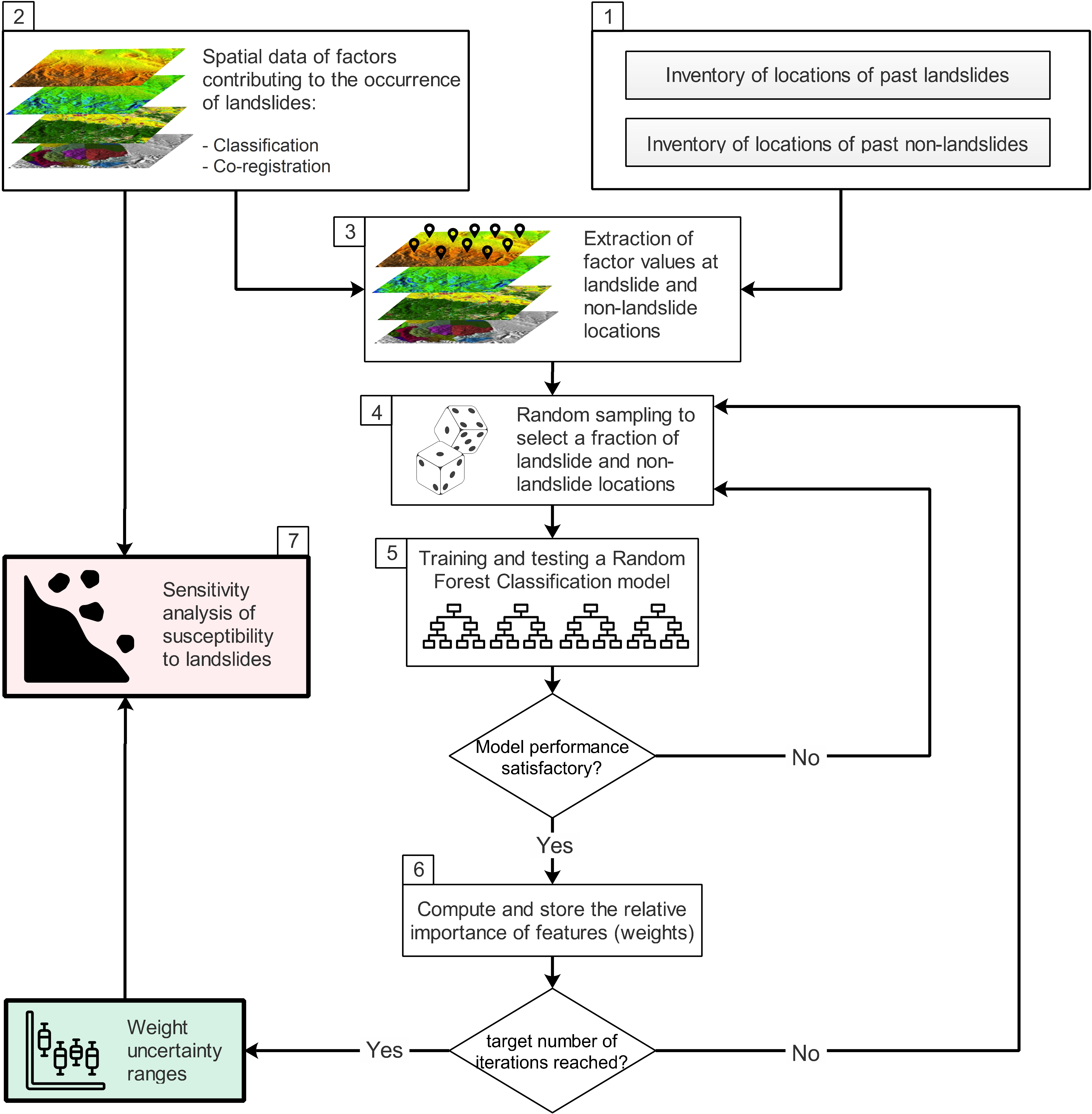
PyLandslide is a tool for spatial mapping of landslide susceptibility. The tool uses "qualitative map combination," in which the effects of multiple factors that contribute to landslide occurrence are combined using weights. The tool uses Machine learning to determine weights and their uncertainties. The tool is also designed to conduct sensitivity analysis based on weight ranges and spatially compare the outcomes of different weight choices.
Landslide susceptibility and uncertainty analysis can be performed in PyLandslide either through high-level commands or using Python code. Either way, some inputs to different methods and functionalities need to be provided through JSON-based document format. The Documentation page provides further details on how to use the tool and provide the required inputs.
PyLandslide works on Python 3.6 (or later) on Windows, Linux, or OS X.
See the documentation for details on how to install PyLandslide.
PyLandslide can be installed by running:
pip install PyLandslideFor advanced users, developers, and those who wish to contribute to the development of PyLandslide, make sure to have installed the required dependencies. Then clone the repository:
git clone https://github.com/WRHGroup/PyLandslide.gitOnce the repository is cloned, navigate to its directory and run:
python setup.py installOr the following for development mode:
python setup.py developPlease cite the following paper when using PyLandslide:
Basheer, M., Oommen, T., 2024. PyLandslide: A Python tool for landslide susceptibility mapping and uncertainty analysis. Environmental Modelling and Software. 106055. https://doi.org/10.1016/j.envsoft.2024.106055.
Copyright (C) 2023, Mohammed Basheer and Thomas Oommen.
PyLandslide is released under the GNU General Public License.
