Dotlas Python Client
The Dotlas REST API enables you to:
Integrate data & insights with your own web or mobile apps
Consume information that supplements in-house data analysis and visualization
Enhance the functionality of your tech stack
Leverage alternative data in your data pipeline
Website • API Documentation • Email • LinkedIn
Setup
Pip
To install Dotlas from PyPi run the following command:
$ pip install dotlasLocal
To setup dotlas from GitHub:
Usage
Basic Calls
import dotlas

dot = dotlas.App(api_key="<YOUR API KEY>")

cities = dot.list_cities()
houston_city_stats = dot.city_stats(city="Houston")

restaurants_near_empire_state_bldg = dot.nearby_competition(
    latitude=40.74861114520377,
    longitude=-73.98560002111566,
    city="New York",
    commercial_type="Restaurant",
)

esb_insights = restaurants_near_empire_state_bldg.response.insights
esb_data = restaurants_near_empire_state_bldg.response.data
Mapping
pip install foliumif you don't have it already.MAPBOX_ACCESS_TOKENcan be obtained from mapbox.com
import folium
MAPBOX_MAP: str = "https://api.mapbox.com/styles/v1/mapbox/light-v10/tiles/{z}/{x}/{y}?access_token={MAPBOX_ACCESS_TOKEN}"
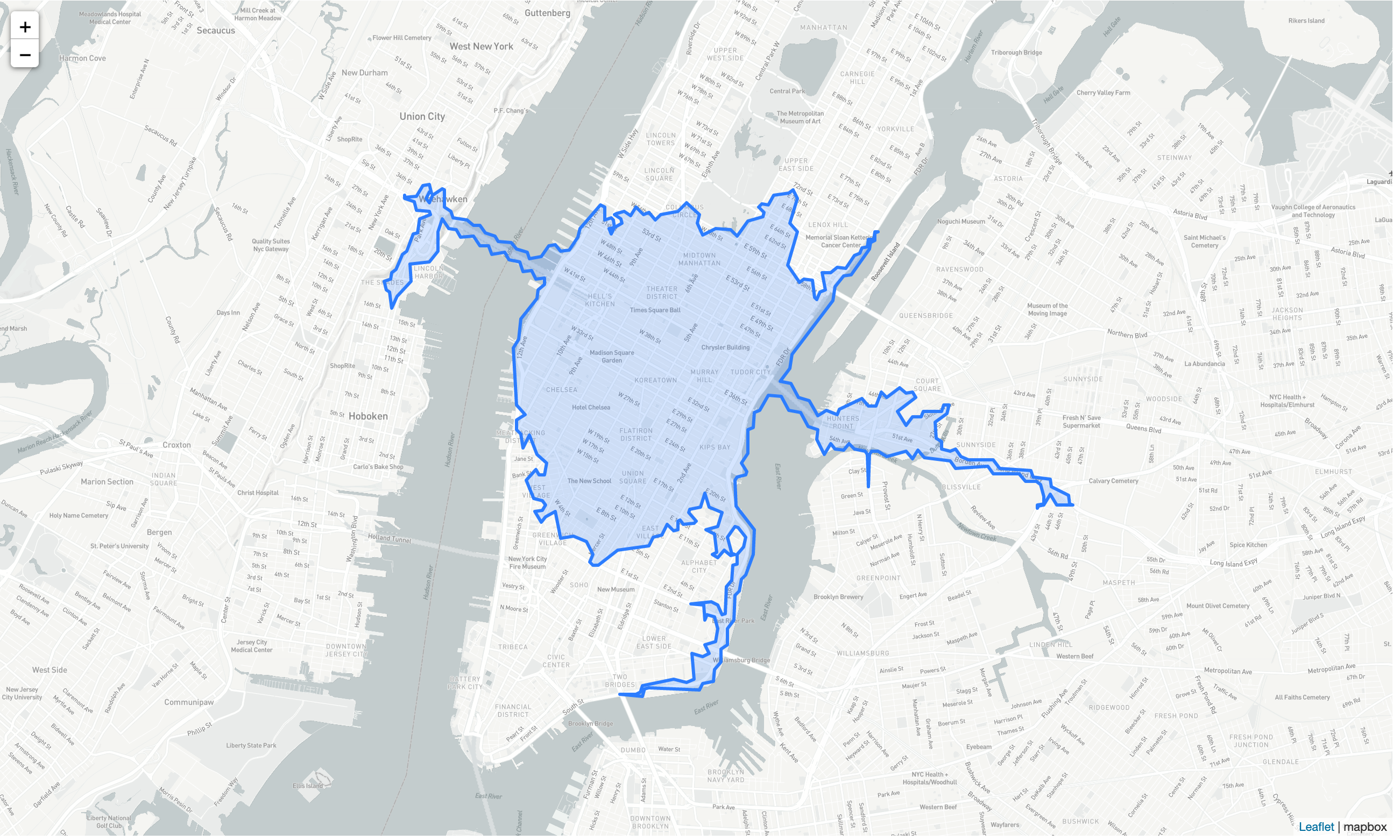
empire_state_building_profile = dot.sales_territory(
latitude=40.74861114520377,
longitude=-73.98560002111566,
city="New York",
time_minutes=10,
mode_of_mobility="driving"
)
folMap: folium.Map = folium.Map(
location=[
empire_state_building_stats.request.latitude,
empire_state_building_stats.request.longitude,
],
tiles=MAPBOX_MAP,
attr='mapbox',
zoom_start=12
)
folium.GeoJson(
empire_state_building_stats.response.geometry.dict()
).add_to(folMap)